Describe a Location
We can use three types of properties to describe a location1:
- Site details (is there a ramp? is it on the wrong side of the road?);
- Accessibility;
- Socioeconomic environment.
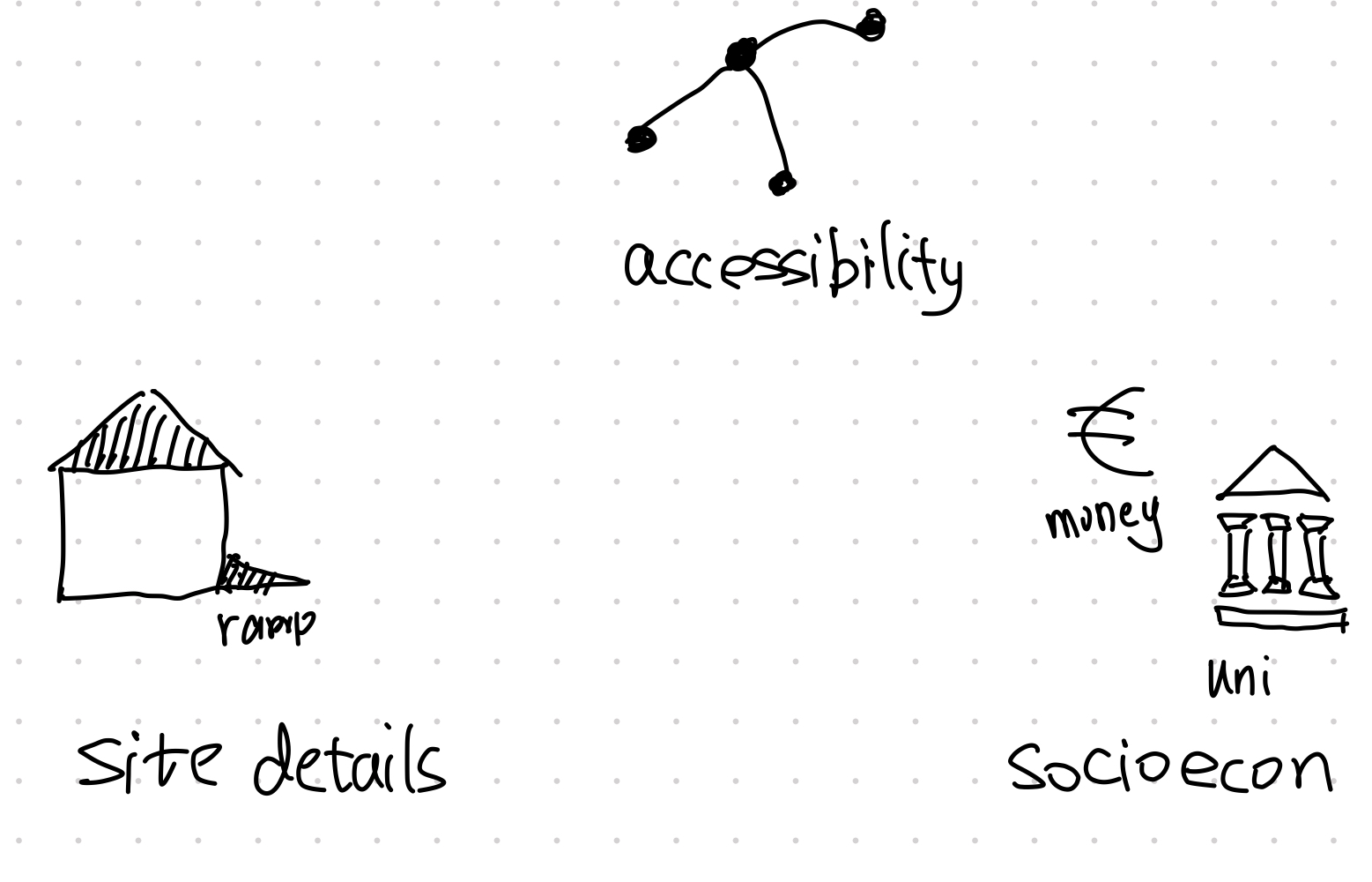
The three types of properties of a location.
The site details and the socioeconomic environment is understood by the name. Here we will discuss the accessibility of a location.
Accessibility of a location
Accessibility is a very important property of a location.
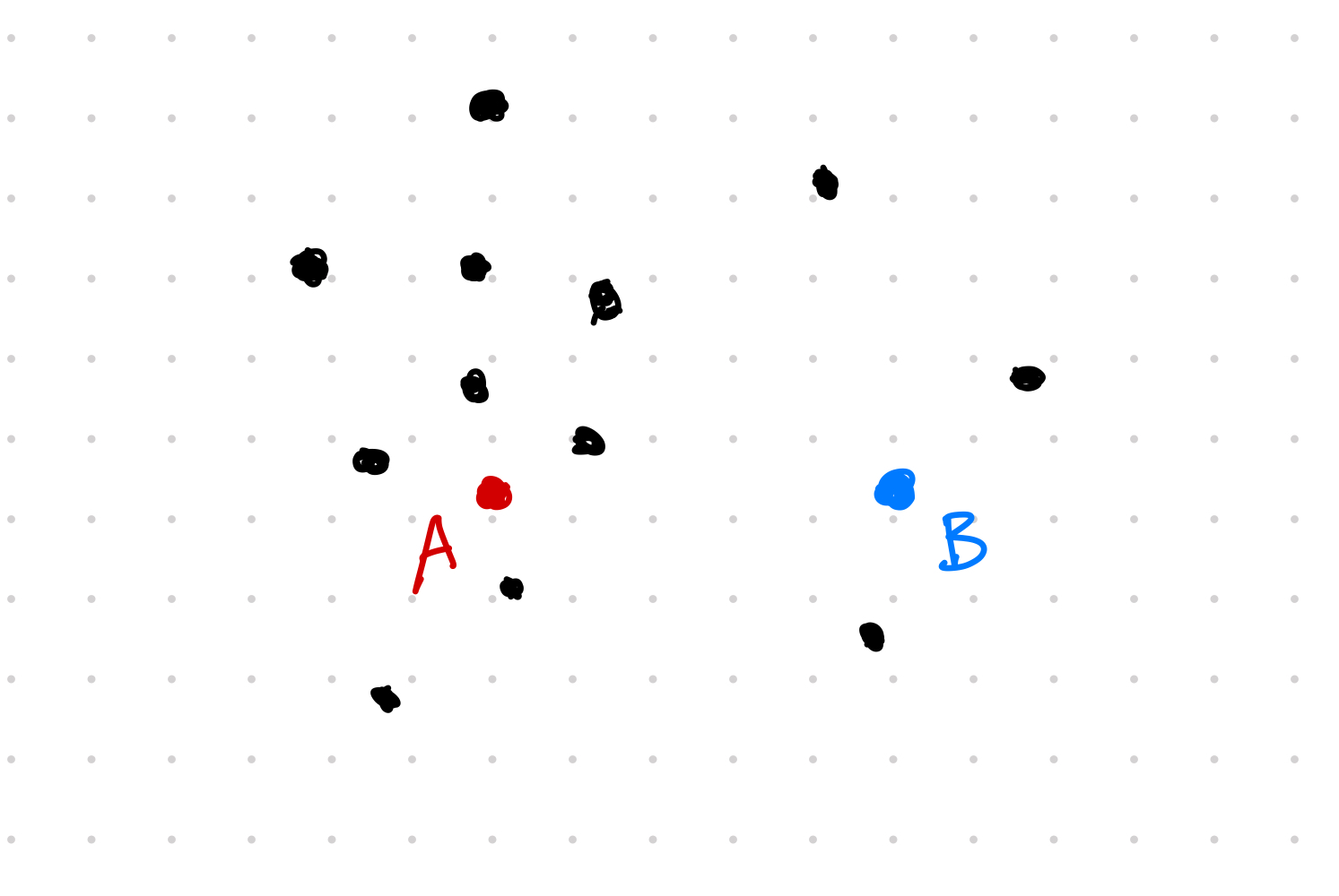
Geolocation of two cities A and B. There are more cities close to A than B thus A is more accessible.
Rodrigue et al provided a definition for accessibility: “measure of the capacity of a location to be reached by or to reach different locations.”1
In the above example, we are measuring the accessibility on the surface of the Earth. This is called contiguous accessibility. The other perspective of accessibility is using graph, which is called topological accessibility.
On a graph, location A has a higher degree than location B. The topological accessibility of A is higher than B.
Measurement of accessibility
To measure the contiguous accessibility, we can use the number of cities included within a circle. By adjusting the size of the radius, we can even get the cumulative counts for different radius.
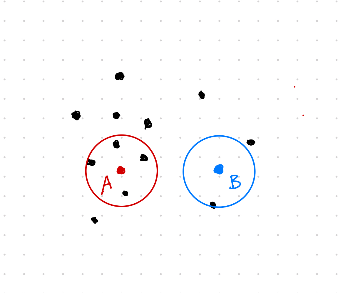
Location A is more accessible than location B as A has more cities in its vicinity
The topological accessibility can be measured by the degrees of the node A and node B.
Using these ideas, we can build scalar values to measure the accessibility of a location, e.g., geographic accessibility $A_G$.
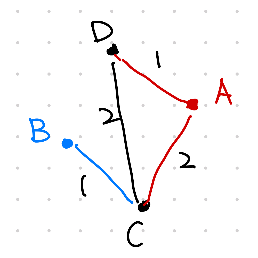
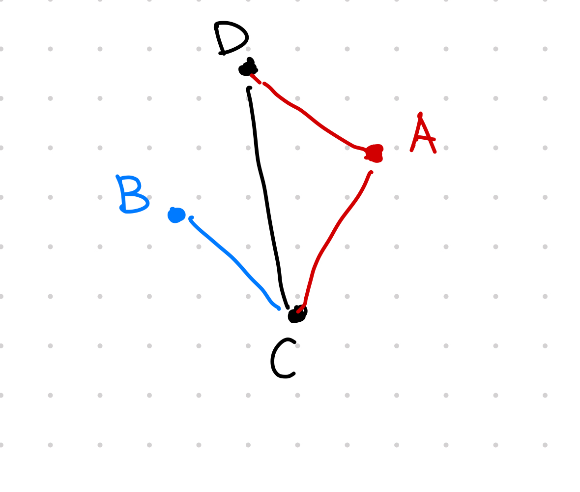
Graph of connected cities.
$A_G$ is defined as the normalized sum of shortest path from the location to all other cities1. For example, from city A to city B, we have all the distances shown in the following table.
| Path | Distance |
|---|---|
| A->B | 3 |
| A->C | 2 |
| A->D | 1 |
| A->A | 0 |
The geographic accessbility is
$$ A_G(A) = \frac{3 + 2 + 1 + 0}{4} = 1.5, $$
where the denominator $4$ is the normalization factor, i.e., the number of cities being considered on the graph.
L M (2021). 'Describe a Location', The Flow, 05 April. Available at: https://flow.leima.is/road-freight/basics/describe-geolocations/.